

This month we explore one of the key features of Coreo – recording location-based data.
Background
Data, especially environmental data, often has a spatial element to it. That is, we need to know where something is or was by recording its location.
Despite advancements in technology, which have made accurate location mapping possible via phones and tablets, many organisations continue to use traditional methods to collect the data, such as pen and paper.
Whilst we’ve used these methods for years they’re often the cause of some headaches including:
- Requiring you to always have a map of each survey area to hand
- Coping with recording overlapping data points, if annotating a map
- Soggy maps
- Wind ravaged maps
- Errors being made when writing coordinates down
- Errors creeping in when transcribing location info into electronic form
- Time it takes to transcribe field notes
How Coreo can help
When you choose to use an app for surveying you get to leverage the technology packed into your phone. Most modern phones these days have good GPS chipsets, meaning that getting accurate locations is both quick and easy. Not everyone realises that GPS works irrespective of your data network. So, even when you’re in the windswept wilderness, miles from the nearest phone reception, you can still record accurate locations.
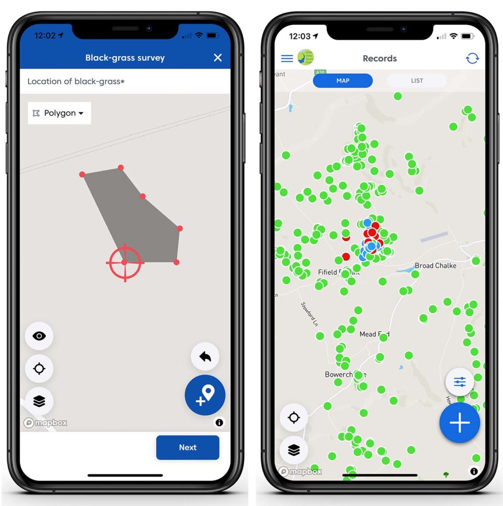
In addition, when you design your surveys in Coreo you get to choose what type of geometries you want available when recording locations. You can choose to record one or any of the following:
- Point locations. These are specific points that represent e.g. the location of a tree. By default, this will be where you are (your phone is) but if your subject is some distance away you can simply relocate the point by tapping on the map.
- Lines or transects. These are linear features such as hedge lines, fences or the location of pipes, wires or boundaries.
- Polygons. These are areas such as field boundaries, ponds, patches of weeds etc.
Once you’ve recorded your data the Coreo app and website allow you to view all your data via a map interface. You can interact with it, edit your records to add further information and also view existing records whilst you’re adding new data. This can be invaluable if you need to add records to an existing location such as adding species sightings to a large boundary such as a SSSI boundary or to a point location such as a reptile tin.
Other advantages of using Coreo to survey for location-based data include that:
- Data is ‘born digital’. There’s no need to spend hours transcribing your surveys into electronic form and then checking everything for errors.
- Surveys work offline. Just upload your data once you’re back online.
- Surveys and data can be shared with anyone needing the information.
- You can easily export all your location-based data in formats such as shapefile and geoJSON for use in other systems.
Location-based data in action!
As a facilitator overseeing a farming cluster group, Simon Smart works with over 100 farmers in Wiltshire, supporting them with monitoring the biodiversity on their farms and taking steps to help them improve their farm management to produce nature-positive outcomes.
Simon adopted Coreo in 2019 after struggling with paper based and a variety of digital solutions that proved too complicated. And since using the app, he has noticed not only an exponential increase in records collected, but also a much improved quality of records.
‘A farmer can see something interesting and I’ll have the record in seconds rather than weeks or months later. They also don’t need to worry about telling me the location as Coreo pinpoints each record for them, even if they’re out in a remote area. This has been one of the major factors in positively transforming the amount of data farmers now collect and it’s massively reduced the time I spend trying to collate records’.
Find out more about how Simon uses Coreo to manage his cluster groups.
Start our free 30 trial today to find out how Coreo’s interactive mapping can improve your data collection, or get in touch to set up a free Coreo consultation with the team at hello@coreo.co.uk.