Introduction
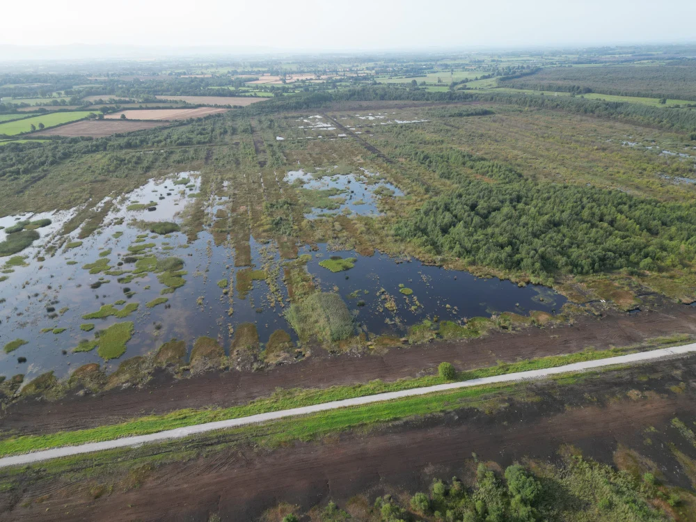
Thanks to a collaboration with BnM, Coreo and Gentian have put their integrated workflow to the test in one of the most ecologically complex environments in Ireland – cutaway bog undergoing restoration. This trial was designed to stress test both technologies as well as the synergy between AI-driven habitat mapping and mobile data collection in a complex peatland environment.
We would like to extend our thanks to the BnM ecology team for their expertise and for putting our integrated workflow to the test at Derrybrat Bog.
The Challenge: Complexity at Scale
Cutaway bogs are demanding environments. For the BnM team, traditional mapping involves labour-intensive manual digitisation of aerial imagery before field visits even begin. With complex mosaics of bare peat, wetland vegetation, and emerging scrub, preparing survey baselines from standard aerial imagery is time consuming and the terrain itself is often expansive and difficult to access.
The Workflow: From Satellite to Screen
The pilot was conducted with a rapid turnaround, demonstrating the speed of a joined-up digital approach:
- Rapid Mapping: Gentian completed high-resolution habitat mapping of the Derrybrat site within a few days.
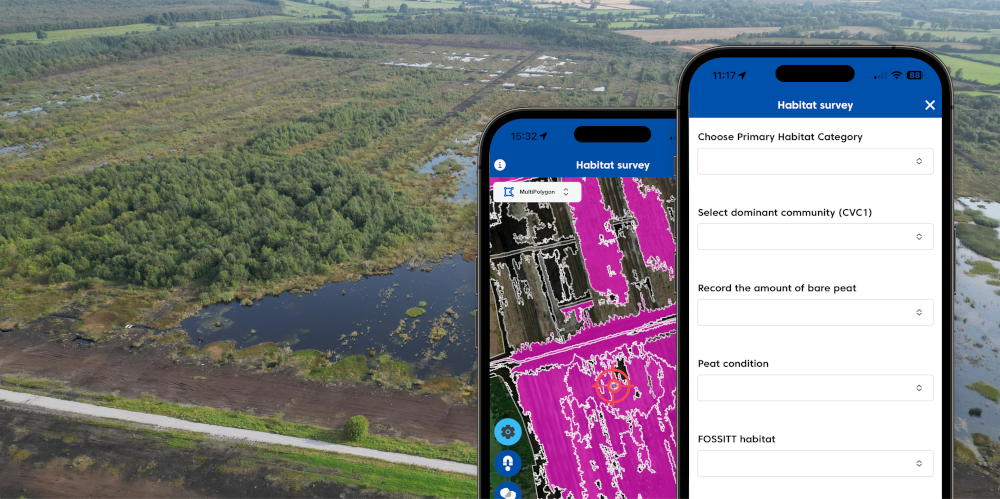
- Seamless Integration: The Coreo team developed a bespoke survey structure to mirror BnM’s bespoke vegetation classification methodology. The survey then displays Gentian’s AI derived habitat data (available offline) ready for field work.
- User-Friendly Implementation: Working to a tight project deadline, the BnM team required only a short online training session with the Coreo team. This was enough for the ecologists to head straight into the field and begin the survey with confidence – testament to Coreo’s intuitive design and ease of use.
- Ground-Truthing: BnM ecologists used Coreo to validate AI classifications noting any discrepancies or interesting findings.
Key Successes
Operational Efficiency & Time Saved
Initial projections suggest that automating pre-survey desk work with Gentian offers considerable time savings compared to manual feature creation. In more straightforward landscapes, the time efficiency would be much greater.
Real-Time Field Synchronicity
A standout feature for the BnM team was real-time data visibility. Coreo allowed surveyors to monitor colleagues’ findings instantly in the field. This ensured total consistency across the site and eliminated both the need for detailed tasking of recording effort and duplication – a vital factor when multiple ecologists are navigating vast, difficult terrain without clear feature boundaries.
High-Precision Baseline Validation
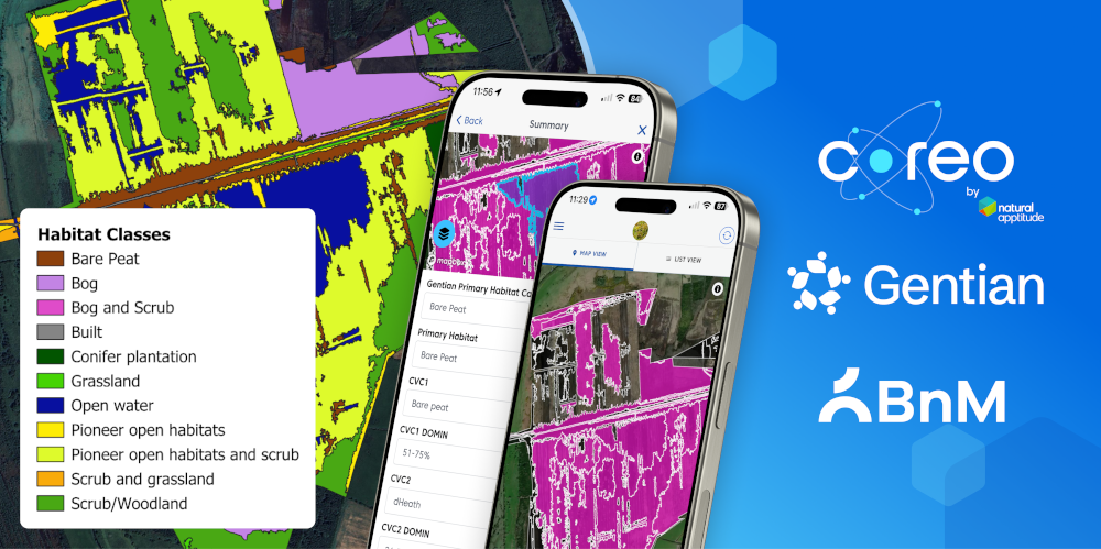
The Gentian model showed exceptional accuracy in identifying bare peat – a critical metric for peatland restoration – as well as good classification of open water and conifer plantations. Using Coreo, ecologists could quickly confirm these high-confidence areas and focus their technical energy on more nuanced vegetation mosaics.
Looking Ahead: Learning from the Pilot
As a true pilot, this study also highlighted clear areas for improvement:
- Refining Mosaics: This field feedback will be used to help both our teams and the AI better distinguish between pioneer open habitats, scrub, and reedbeds.
- Polygon Optimisation: Future iterations will focus on balancing granularity and usability, ensuring that polygon size provides high definition without overwhelming the user interface.
- Long-Term Monitoring: The development of monitoring features in Coreo will be vital to help track long-term restoration projects like Derrybrat Bog.
Conclusion
The Derrybrat Bog study has shown the enormous potential of AI-derived habitat mapping. It has reinforced some well understood issues (it is not a ‘magic bullet’ – especially with complex mosaic landscapes) and shown some less expected areas for us to focus on (that the balance between detail and functionality when creating features is critical). This pilot serves as a clear reminder that the expertise of field ecologists is essential to refine and validate remote-sensed data. By bridging the gap between satellite intelligence and field expertise, we aim to ensure that rehabilitation and restoration efforts are more efficient, more transparent, and ultimately, more successful.