A Strategic Partnership for Professional Ecologists
Why This Partnership Matters
High-quality ecological data is only as good as the expertise behind it. While technology can identify patterns, it cannot replace the specialised knowledge required to interpret complex ecosystems.
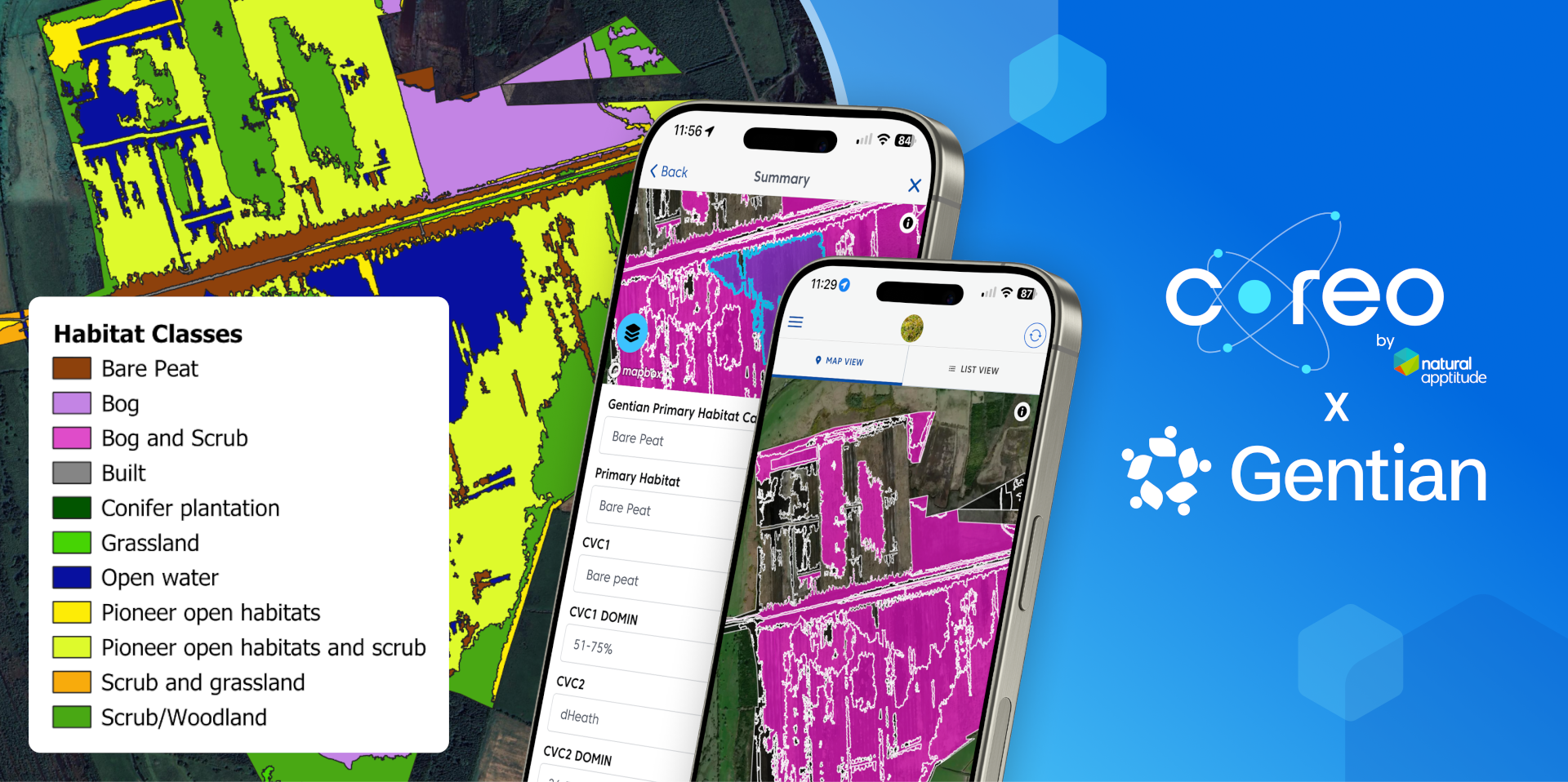
Coreo and Gentian have joined forces to bridge the gap between remote sensing and the field. By combining Gentian’s ultra-high-resolution satellite imagery and AI analysis with Coreo’s industry-leading digital data collection platform, we are providing a seamless, end-to-end workflow designed for the modern ecologist.
Key Benefits From Our Combined Workflow
Automating Baselines at Scale: Use Gentian’s AI to handle the initial, time-consuming task of mapping habitats across any geographic scale – from single sites to entire landscapes. By eliminating the administrative burden of manual digitisation, you can establish robust baselines and monitor long-term changes with consistent precision.
Maximising Professional Expertise: By streamlining preliminary mapping, we free you to focus on high-level tasks – such as fine-tuning habitat features, undertaking condition assessments, and site-specific appraisals.
Delivering UKHab & BNG Compliance: Seamlessly move from Gentian’s remote analysis to Coreo’s field validation in one joined-up workflow. By bridging the desk-to-field gap, we ensure your data remains consistent and provides the audit-ready evidence needed for BNG baselines and professional reporting.
Transforming Your Workflow
Walk onto site already knowing what’s there: Turn field visits into targeted ground-truthing rather than blank-slate surveys. Gentian x Coreo provides a detailed remote-sensed habitat map before you even set foot on site. The Value: Cover more ground in less time. This is especially critical when planning permissions, landowner access windows, and seasonal constraints limit your days in the field.
Unlock revenue in the off-season: Traditional surveys are often locked to the spring and summer window, leaving winter months commercially quiet. By combining Gentian’s data based on archived satellite and aerial imagery with Coreo’s field workflow, ecologists can deliver credible desk-based baselines and pre-assessments year-round, opening up billable work through winter when ground surveys are simply not an option. The Value: Open up billable work through the winter when ground surveys are not an option, ensuring a steadier commercial pipeline.
One connected workflow: Desk to Field to Deliverable: Gentian’s remote-sensed habitat maps flow directly into Coreo, allowing you to capture, validate, and refine findings in a single, joined-up tool:
UKHab-compliant outputs to support BNG baselines
Faster turnarounds for client reporting
Scalable delivery without the need to add headcount during peak season capacity squeezes
Efficiency Without Compromise
This partnership is about unlocking efficiency without replacing expertise. We handle the data-heavy mapping so you can apply your skills where they have the greatest impact: for nature restoration, conservation, and sustainable development.
 Menu
Menu